If you are planning a trip to Cornwall, stop thinking about just the beaches. There is a whole other side to this peninsula that most visitors skip because it is harder to reach. This is North Cornwall. It is not the postcard-perfect coves of Newquay or the tourist traps of St Ives. It is raw. It is wind-scoured. It is where the land finally gives up and crashes into the Atlantic.
Most people don’t realize that this region used to be a distinct district before the local government reshuffles. But the geography hasn’t changed. You are standing on the edge of England, or so the locals will tell you.
Where the Counties Collide
Here is a detail most travelers miss. North Cornwall isn’t entirely Cornwall. Historically, an area west from Werrington along the River Otter belonged to Devon. You can almost feel the shift in the landscape if you drive north from Exeter. The soil changes. The accents change. It is a patchwork of historic boundaries that still matter to the land itself.
The terrain here is elevated. Open. Exposed. If you drive inland, you hit Bodmin Moor. It is a bleak, granite intrusion that sits at the center of the southern border. The altitude hits 800 feet and climbs to nearly 1,400 feet. That is high ground for this part of England.
Why does it look so empty? The winds are relentless. The soil is infertile. Nothing grows here except grass. It is a stark, minimalist landscape that feels ancient. The government has designated most of Bodmin Moor as an Area of Outstanding Natural Beauty. It sounds like a bureaucratic label, but standing on the moor, you understand why. It is protected not for its beauty in the traditional sense, but for its wildness.
The Coastline That Breaks You
Turn north. The landscape drops. You hit the coast.
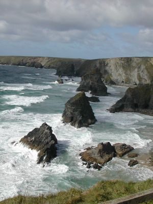
The northern coastline stretches for 50 miles. That is 80 kilometers of uninterrupted wildness. It is not a gentle curve. It is a surf-beaten line of steep cliffs. The Atlantic hits hard here. The waves are higher. The weather is worse.
This is not a place for sunbathing. It is a place for staring out at the horizon until your neck hurts.
The cliffs are rugged. They are designated Areas of Outstanding Beauty for a reason. They are dramatic. They are dangerous. You need sturdy shoes here. The paths are often narrow. The wind can knock you off balance if you aren’t careful.
Rolling Hills and Grazing Grounds
Leave the cliffs and head southeast or southwest. The terrain softens. You are no longer on granite. You are on sedimentary soils. This is lower, rolling land.
It is suitable for fodder crops. It is rough grazing land for dairy cattle. You will see cows. Lots of them. They are scattered across the hills, small against the vast sky. This is the agricultural heart of the region. It is quiet. It is green. It is the opposite of the stark moor.
Why You Should Go
Most tourists flock to the south coast. They miss the north entirely. But if you want to see England at its most elemental, you go here. You go to see the land before
Where History Meets the Coast
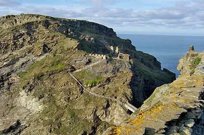
You can’t walk through Tintagel without feeling the weight of myth. It is the legendary birthplace of King Arthur. The village clings to the cliffs, a postcard dream for rock climbers and hikers who flock here. If you head south, just three miles to Delabole, the vibe shifts from fantasy to grit. The slate quarry there has been churning out roofing stone since Henry VII’s reign. That is late 1400s. Most of Cornwall’s historic roofs owe their existence to this specific patch of earth. It is continuous work. Deep history. Literal stone under your feet.
Inland from the Surf
Leave the coast if you want to see where Cornwall actually works. Bodmin sits in the southwest. It was once the district seat. Launceston is in the southeast. Agricultural and light industrial hubs now. But they were once the seat of the county itself. Different times, different power centers. You can trace that shift by looking at the old administrative buildings. They stand there, quietly asserting a past authority.
Between them lies Bodmin Moor. It is stark and open. Prehistoric monoliths dot the landscape. Standing stones that mark boundaries or burial sites from millennia ago. They are silent witnesses to the tides of history.
The Eastern Edge
Travel east to the Tamar valley. The land flattens out. Here, fruits and vegetables grow. The soil is rich. The valley forms the eastern border of the district and Cornwall. It is a stark contrast to the rugged moors. Productive. Green.
Nowhere is the intersection of the ancient and the modern more visible than at Widemouth Bay. Near Bude in the extreme north. A transatlantic telephone cable extends from this spot. It heads to Canada and the United States. You are standing on a cliff edge. Below you, the Atlantic. And under the waves, a physical connection to North America. The past, the present, and the future, all in one glance.
461 square miles. That is the area. A place where legends are born in villages, slate is quarried for centuries, and cables span oceans.